The Ordnance Survey, which is marking its Irish bicentenary this year, has been renamed Tailte Éireann in the Republic, while in the North it is called OSNI. The intriguing backstory behind the survey’s evolution from 1824 is charted by Finnian O’Cionnaith, a qualified land surveyor.
His narrative is condensed into a period of 129 days outlining the work of select committees, the role of the main figures and the disagreements that surfaced. Prior to 1824 there had been many surveys of Ireland but cartographically the country lacked a reliable mapping agency. The triangulation network carried out by the OS defined the scheme in scientific precision, although the British survey – started in 1791 – and the later Irish one are two different entities.
The Irish survey was born out of political compromise, being military in essence but civilian in purpose. A significant issue was tax reform and, as there was a need for a new valuation of the country, land-based taxes were at the core of the work. Its formation reflected Ireland’s post-union status, which meant that the needs of Westminster dictated the methods used.
Lengthy deliberation and negotiations took place during an increasingly unpredictable political situation. The task undertaken by surveyors was daunting as they charted the perplexing labyrinth of townlands, many only a few dozen acres in size. But there was suspicion in rural Ireland’s collective consciousness, partly because of previous mapping projects and the forcible confiscation of land; in some cases farmers engaged in sporadic vandalism.
READ MORE


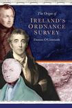
The role of the parliamentary commission in the emergence of the OSI forms the dominant part of the book with testimonies from a range of people. The author paints portraits of significant personalities such as Thomas Spring Rice, the MP for Limerick who led the committee; Arthur Wellesley, the duke of Wellington and master general of Ordnance; and Maj Thomas Colby, superintendent of the survey. A leading figure in Irish engineering, Richard Griffith, gave his name to the Griffith’s Valuation records that are today widely esteemed by historians and archivists searching for details of the value of property and land.
As well as a valuable insight, filled with authoritative footnotes, this is a tasty appetiser of the OSI’s primordial days that may perhaps lead to a wider banquet.
Paul Clements’s latest book is Life from Both Sides, Jan Morris: A Biography (Scribe)