Tornado-like funnel clouds sighted across Ireland in recent days have caused a social media storm but are “relatively common”, according to a leading climatologist.
John Sweeney, Professor Emeritus of Geography at Maynooth University, also warned that they are likely to become more prevalent and potentially more extreme as the impact of climate change become more pronounced in the future.
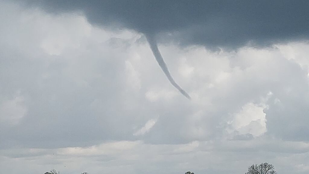
A funnel-shaped cloud of condensed water droplets was recorded over Dublin Airport on Tuesday as thunderstorms swept across the country.
Prof Sweeney said such clouds share many characteristics of tornadoes and tend to happen when there are high levels of thunderstorm activity in an area.
READ MORE


They can be generated as a result of a “violent uplift in an area where there’s lot of convection [and] contrasting air masses at the surface and higher up”.
He said it wasn’t clear if the spate of them in Ireland this summer was consequence of warming but added that “one of the things you would expect as the ground becomes warmer is that they will become more common in the future”.
He also pointed to climbing ocean temperatures off the west coast of Ireland and said that “offshore water spouts combined with thunderstorms above the ocean means they’re going to produce more frequent funnel clouds there as well”.
He said that one reason they were attracting more attention now was because people were much faster to record them. “With smartphones you can photograph them instantly now in the way you couldn’t in the past, so you can see a lot more people reporting them,” he said.
He pointed out that farmers in the West of Ireland “certainly had an awareness of these kinds of funnel clouds in the past. My grandfather used to talk about them and how they would scatter haystacks.”
While there has been no record of damage this week, there have been occasions in the past when funnel clouds have caused significant upheaval.
[ Flooding in parts of Dublin and Kerry as ‘extremely intense’ rainfall recordedOpens in new window ]
He recalled one in Co Meath several years ago which “left a clear pathway of destruction” and cited a storm in Dublin city more than 100 years ago which smashed windows and knocked trees in College Green, with some felled in one direction and ones beside them knocked in the opposite direction. “That was kind of an indication of that kind of column,” he said.
There was, as he pointed out, no social media, and no smartphones to capture that event, so the only witnesses would have been those standing in its path.


