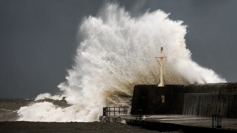
The Government has instructed local authorities to activate their severe weather and crisis management teams as high winds from Storm Diana are expected to batter counties along the south and west coasts on Wednesday.
All cargo terminals at Dublin Port were closed for a number of hours on Tuesday as a result of strong winds from a separate weather system. Restrictions were in place at the Port Tunnel which led to a severe backlog of traffic and hundreds of lorries waiting to enter the port.
Met Éireann meteorologist Liz Walsh on Tuesday night said those conditions were due to an easterly airflow with a squally front that brought heavy rain and strong gusty winds. The highest winds of 105km/h were recorded at Roche's Point and Sherkin in Co Cork.

At Dublin Airport, winds reached 75-80km/h. In terms of rainfall, 26.9mm fell at Valentia in Co Kerry, while 21.7mm was recorded at Oakpark, Co Carlow. There were also reports of some structural damage to houses in Co Waterford.
Milder conditions
Ms Walsh said Tuesday’s weather system would give way to a “more mobile Atlantic regime”, which will draw milder conditions and tropical maritime air, but which will also be “more active and vigorous”.
Met Éireann has issued a status orange wind warning for Cork, Kerry and Waterford from 6am until 12pm on Wednesday. A status orange warning for wind has also been applied to Wexford, Clare and Galway from 6am to 2pm.
Orange level winds reach speeds of 65 to 80km/h, and gust from 110 to 130km/h. High seas are also expected, with a risk of coastal flooding.
A yellow wind warning, which involves speeds of 55 to 65km/h and gusts of 90 to 110km/h, is in place nationwide from 5am to 6pm.
“Diana is going to travel northwards along the west coast of Ireland, but the associated fronts and winds will impact over the country,” said Ms Walsh.
“The wind will be from the south to southwest, so different areas are going to feel it differently. Parts of Dublin for example will probably be quite sheltered from that direction with the Wicklow Mountains, so the winds won’t feel quite as bad as Tuesday.”
‘Strong winds’
She said many eastern and southern areas will not see the rain as heavy as they did on Tuesday, “but Atlantic coastal counties like Mayo, Galway and Donegal will, so they’ll have heavy rain and strong winds”.
“We’re particularly concerned about the coastal areas in the west and south, from Wexford all the way around to Galway. Co Kerry in particular looks like it’s going to see some orange-level winds for a time from early morning to early afternoon.
“Diana has already done her deepening phase, so she’s a maturing system as she comes towards Ireland. This makes her less active than she could have been, so in some ways it’s more likely that very strong mean wind speeds will be the issue rather than gusts.”
The National Directorate for Fire and Emergency Management, which is the Government body that co-ordinates emergency responses, said it had been in contact with all local authorities and instructed them to activate their severe weather teams.
High-tide updates
Local authorities have also been told to monitor the weather forecast and high-tide updates, and to activate local co-ordination and crisis management arrangements where necessary.
The Department of Transport has been told to relay advice to the transport sector and the Coast Guard.
The Road Safety Authority has urged road users to be aware of objects being blown out on to the road, and to watch out for falling or fallen debris on the road, as well as veering vehicles.
Clare County Council warned members of the public to avoid exposed coastal locations due to the storm, and indicated that any areas that have previously flooded are at risk and that people in such situations were advised to take appropriate precautions.
Meanwhile, the Cliffs of Moher Visitor Experience will be closed to visitors from 9am to 2pm.


